

Gedong Bazaar is part of the newly established Gedong District in Samarahan Division. From Kuching City, it is located about 90km via the Pan Borneo Highway and over 100km by way of the Coastal Road Network.
Driving there through Sarawak’s southern coastline requires travelling on the Kuching-Samarahan Expressway to enter Samarahan Division, and then passing by small towns of Kota Samarahan, Asajaya and Simunjan before heading south towards the destination.
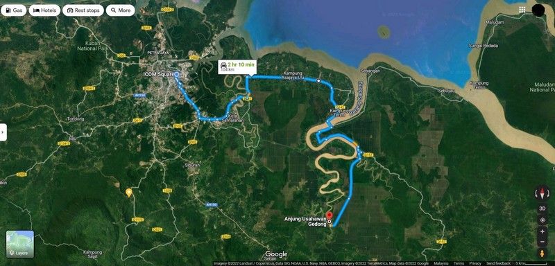
This involves crossing a series of bridges including the Batang Samarahan Bridge, Batang Sadong Bridge and Gedong Bridge, as well as navigating the occasional slow traffic on the single carriageway commonly used by the residents of kampungs found along the route.
During a recent visit to Gedong, the RAKAN Sarawak team opted for the Pan Borneo Highway, which meant driving on Jalan Kuching-Serian and Jalan Serian-Sri Aman before turning left onto the road leading to the bazaar after passing by the Semuja Immigration Detention Centre.

According to estimates by Google Maps, this route takes about one and a half hours – around 30 to 40 minutes less than going through the Coastal Road Network, without taking account of traffic conditions.
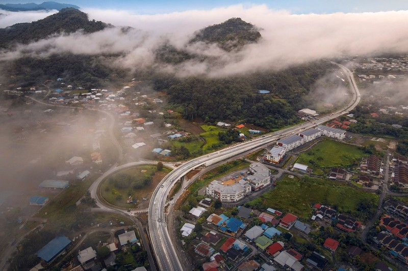
Despite ongoing constructions of flyovers at Mile 6, Mile 7 and Mile 10 at Jalan Kuching-Serian compounding the weekday morning traffic congestion, as well as the rainy weather posing safety hazards on the road, the team reached Gedong safely – albeit arriving past the estimated travel time at close to two hours.
Unlike the Coastal Road Network, the Pan Borneo Highway is a dual carriageway that has limited access to adjacent properties or settlements, enabling road users to drive at high speed when necessary.
It also allows them to bypass Serian Town through its twin flyovers so they will not get caught in traffic in the town’s commercial area, further reducing the travel time.

The only single carriageway the RAKAN Sarawak team used for the Pan Borneo Highway route was the road that led straight to Gedong following the aforementioned left turn.

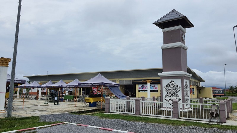
Technically called Route 8107 on the map, it winds through villages, forests, plantations and even schools before eventually reaching Anjung Usahawan Gedong in the centre of the bazaar.
With its accessibility via Sarawak’s two major road networks, Gedong can be said to possess the land connectivity needed to grow as a satellite town for Samarahan Division.

Such ease of access – which is further elevated by the upgrading of Gedong into a district – also provides socio-economic opportunities for the local community to improve their standards of living through tourism activities such as songket weaving and boat racing that can attract visitors from as near as Kuching, Samarahan and even Serian.


