Floods, unfortunately, are annual affairs in Malaysia. In Sarawak, they usually occur during the north-east monsoon between November and March. The State is also susceptible to flash floods, especially in low-lying urban areas; at times, just a few hours of heavy rainfall can lead to a sudden surge in water level.
Through its agencies, the Sarawak Government undertakes various measures involving technology to detect and monitor floods as well as send flood warnings to those who may be affected by potential disasters.
Sarawak Rivers Board, for instance, has established a telemetry system comprising over 20 telemetry stations located at river catchments particularly in the Sungai Sarawak Basin that feed real-time data and provide early flood warnings to Sungai Sarawak Barrage when the river water hits a dangerous level.
Like its federal entity, DID Sarawak has also made use of technology to enhance its capability to mitigate floods in the State. Among them are:
Intelligent Gauge
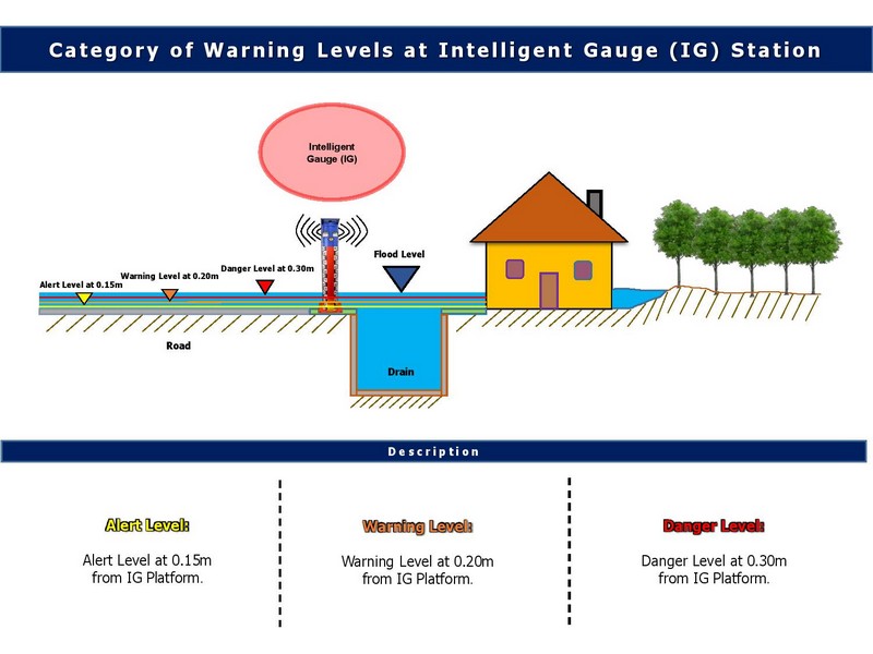
Intelligent Gauge (IG) is the result of an innovative project by DID Sarawak’s Kumpulan Inovatif dan Kreatif (KIK) DID Kenyalang, which earned a four-star rating and won the Sarawak Chief Minister Innovation Award during the State-level KIK Convention in October 2017.

Four of these devices have been installed at flood prone areas in Kuching City so far. They provide real-time water level data for flood monitoring and send early flood warning via siren and strobe light to residents living nearby.
Additionally, data from IGs are delivered to officers of DID Sarawak under the DID Disaster Task Force team via short message service (SMS), who will then relay them to the Sarawak Disaster Management Committee.
iHydro
Data from the four Intelligent Gauges are also displayed in iHydro, an online telemetry web-based system that was developed to assist relevant authorities and the public for flood monitoring and early flood preparation planning.

It shows information such as rainfall data and water levels of rivers in Sarawak in real time and is updated every 15 minutes.
At the time of writing, iHydro is able to display data from 250 rainfall telemetry stations and 109 water level telemetry stations throughout the State.


