The State of Sarawak has a total area of 124, 450-kilometre square.
As the biggest state in Malaysia, it was not an easy task to put Sarawak’s topography into the form of maps as our terrains itself posed as a challenge for map drafters.
During an interview with RAKAN Sarawak with the Department of Survey and Mapping Sarawak (JUPEM Sarawak), the Director of Survey (Sarawak Topography Mapping Division) Sr Sylvester Luta Anak Buli showed us some of the dangers and challenges of map drafters while carrying their tasks back in the days.

Aside from carrying heavy equipment needed for map drafting, they have to climb mountainous terrains as well as experiencing helicopter crashes.
These days however, the field or survey and mapping has been made easier through the application of technologies such as the unmanned aerial system or drones, satellite images and the geospatial data acquisition system.
In 2019, the Department of Survey and Mapping Sarawak (JUPEM Sarawak) reached another milestone when it completed the 1:50 000 -scale map covering the whole of Sarawak in 2019.
“The 1:50 000-scale map is used for military operation. We are now moving on to 1:10 000-scale map which will be more detail,” said Director of Survey (Sarawak Topography Mapping Division) Sr Sylvester Luta Anak Buli during an interview with RAKAN Sarawak.
Starting in 2019 until present, the 1:10 000-scale mapping is still at 6 per cent at the time of writing.
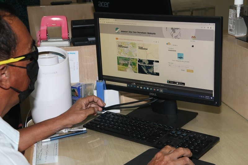
Now, members of the public can purchase maps as well as have access to other services from JUPEM through online.
Objective for the establishment of JUPEM:
- Carry out measurement work and updating of topographic details in accordance with the specifications set for the publication of various series of maps
- Carry out geodetic survey work in accordance with the specifications and work procedures of the department to establish the National Geodetic Datum
- Carry out work on the demarcation, measurement and maintenance of international borders between Malaysia and neighbouring countries whether land borders or maritime borders to preserve the interests and sovereignty of the country
- Carry out airborne data acquisition work
(Source: JUPEM Sarawak)
According to Sr Sylvester, JUPEM Sarawak started offering online purchases of maps from the counter through online application in 2018.
JUPEM was established on 1 January 1989, in which Sr Sylvester noted the three main roles of JUPEM includes mapping, geodetic measuring and measuring international borders between Malaysia and neighbouring countries.
Speaking on the JUPEM geoportal, eBiz, Sr Sylvester said since it was introduced it has been one of the biggest achievements of the department as it increases their engagement with members of the public.


The geoportal allows all applications for geospatial information and JUPEM services to be processed through a single access window that provides shopping malls and booking services.
Geospatial information can be referred to as information or data that is spatially on the surface of the earth.
“For instance, what if someone from the rural area comes to our office to buy our maps and the maps are not available?”
“Each map cost about RM10 to RM20, but the cost on transportation alone for those coming from the rural areas can be up to hundreds of ringgits,” said Sr Sylvester.
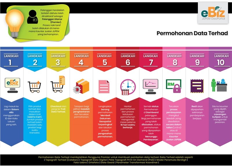
Hence the public does not need to go through such hassle anymore as with eBiz, applicants can make purchases as well as online applications without having to physically go to the counter to get forms and products.
For regular users, they may upgrade to Primary User to allow them to enjoy the service where they can make online payments using prepaid and download digital data instantly via geoportal.

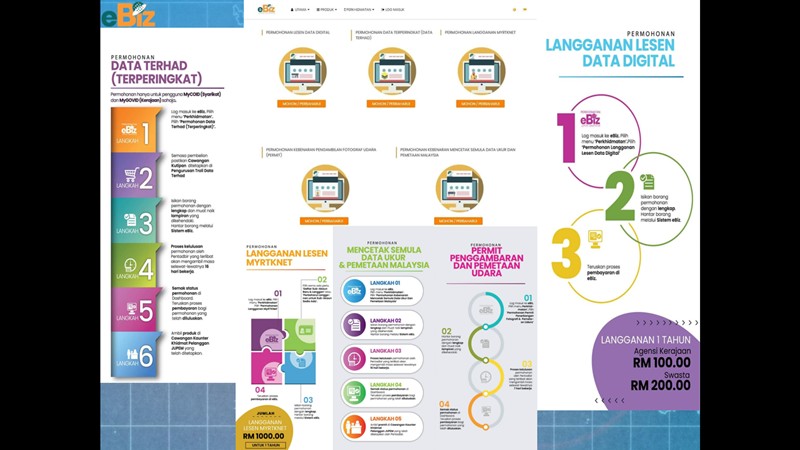
Under eBiz, the online application includes;
- Digital data license application
- Restricted data application
- MyRTKNeT subscription application
- Permission for carry out photography (Permit)
- Permission to re-produce air photo/maps of Malaysia
Among the products that are available at JUPEM includes;
- Serial Topographic Mapping
- Serial City Mapping
- Aerial Photography
- Thematic Maps
- Digital Maps
- Electronic Map (eMAP)
- Astronomical and Falak Syarie data
- Geodesy Data and Information
(Source: JUPEM Sarawak)
To know more, please visit https://ebiz.jupem.gov.my/


