Since its elevation from sub-district to full district at the end of 2021, Sebuyau is in the midst of becoming a coastal commercial hub.
Among many other initiatives, plans are underway to revitalise the local agriculture sector with large-scale coconut and pineapple plantations, while a new township is currently being developed in the coastal district of Samarahan Division – all to boost the local population’s socio-economic well-being.
Before such aspiration can be realised, however, there is the urgency to protect Sebuyau from frequent flooding and coastal erosion.
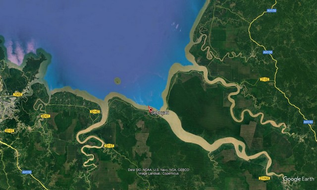
Located along the banks of Batang Sadong and Batang Lupar, as well as the coast facing the South China Sea, it is susceptible to different forms of floods, particularly:
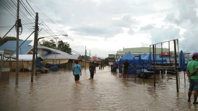
- Flash flooding in small towns of Sebangan and Sebuyau due to inefficient drainage system;
- Stagnant flooding in the hinterland that is slow to recede after heavy rain; and
- Coastal flooding that affects most parts of Sebuyau District, contributing to the erosion of its already fragile coastline, and causing devastating consequences to agricultural land, settlements, and commercial areas.
As early as the 1960s when road connectivity was underdeveloped in Samarahan’s coastal wetlands, the Sarawak State Government through the Department of Irrigation and Drainage Sarawak (DID Sarawak) established proper drainage and irrigation schemes to enable large-scale agricultural production that could in turn improve the economic capacity of the local population.
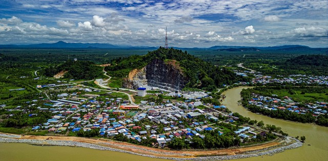
In Sebuyau District, the Sebangan-Bajong Drainage Scheme stretches from areas of Sebangan to Sebuyau Town, and is surrounded by embankments that before were capable of preventing saline seawater from entering agricultural land.
Unfortunately, these embankments as well as the drainage and irrigation systems were worn away as decades went by, exposing the land to high tide and floods. Rendering soils in the area barren and infertile, it caused a massive economic loss for the people.
Various efforts have been undertaken by DID Sarawak to tackle challenges of coastal flooding and the subsequent erosion, according to the Department’s Samarahan divisional engineer Ir Irwandee bin Reduan.
And he believes recent initiatives proposed by the Sarawak Government through regional development entity Integrated Regional Samarahan Development Agency (IRSDA) might be the most comprehensive yet, with the immense potential of reducing these natural phenomena.
“Since 2018, we have been actively involved in IRSDA, which is established to expedite the development process in Samarahan Division.
“For our part, we carry out large and small-scale projects in all state and federal constituencies in the division,” he says in an interview with RAKAN Sarawak.
He adds that small-scale projects or minor works under IRSDA focus on solving “localised problems” in settlements and agricultural land that are often threatened by floods, be they outdated drainage systems or water overflow from upstream.
Of greater importance are major, high-impact ones that are crucial in bolstering protection of Sebuyau’s coastal land.
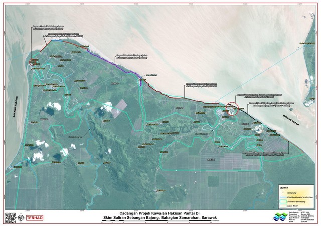
Under IRSDA, seven of these projects are implemented by DID Sarawak, encompassing the length of the district’s coastline of 26.709km from the end of Sebangan Town to the approach towards the upcoming Triso Bridge.
Out of the seven, describes Ir Irwandee, five are coastal erosion control projects at blocks A, D, E and F of the Sebangan Bajong Drainage Scheme, while the remaining two are flood mitigation structure projects at Sebangan and Sebuyau Towns (Table 1).
| No. | Project Title | Project Scope |
| 1 | Proposed Coastal Bund And Drainage System At Sebangan Bajong Drainage Scheme Of Block A, Samarahan Division (Phase 1) | Construction of rock revetment (lapis lindung batu) and related works (4.365km) (Crest level = 7.1m) |
| 2 | Proposed Coastal Bund And Drainage System At Sebangan Bajong Drainage Scheme Of Block A, Samarahan Division (Phase 2) | Construction of drainage system and related works (2.5km & 4.2-acre pond)Construction of river wall (220m)Construction of tidal gate (2 units)Upgrading of existing roads (1.2km)Upgrading of existing perimeter bund (2.8km) |
| 3 | Proposed Coastal Bund And Drainage System At Sebangan Bajong Drainage Scheme Of Block D, Samarahan Division | Construction of rock revetment (lapis lindung batu) and related works (5.7km) (Crest level=7.0m)Construction of culvert (600mm & 900mm diameter HDPE)Construction of gabion mattress at Kampung Tebelu (800m)Installation of 1200mm HDPE flap gate |
| 4 | Proposed Coastal Bund And Drainage System At Sebangan Bajong Drainage Scheme Of Block E, Samarahan Division | Construction of rock revetment (lapis lindung batu) and related works (8.5km) (Crest level=7.1m)Construction of tidal gate (2 units) |
| 5 | Proposed Flood Mitigation, Coastal Bund And Drainage System At Sebangan Bajong Drainage Scheme Of Block F, Samarahan Division (Phase 1) | Construction of rock revetment (lapis lindung batu) and related works (4.104km) (Crest level=6.5m)Construction of culvert (2 units of 1.5m diameter pipes) |
| 6 | Proposed Flood Mitigation, Coastal Bund And Drainage System At Sebangan Bajong Drainage Scheme Of Block F, Samarahan Division (Phase 2) | Construction of rock revetment (lapis lindung batu) and related works (2.99km) (Crest level=6.5m)Construction of one creek closure |
| 7 | Proposed Flood Mitigation, Coastal Bund And Drainage System At Sebangan Bajong Drainage Scheme Of Block F, Samarahan Division (Phase 3) | Construction of drainage system and related works (1.138km)Construction of river wall (0.83km)Construction of pedestrian walk (0.894km)Upgrading of existing roads (0.486km) |
Table 1: Details of major projects implement by DID Sarawak under IRSDA. (Source: Department of Irrigation and Drainage Sarawak, Samarahan Division Office)
Upon completion of all seven infrastructure projects, the coastline along Sebuyau District will be protected from coastal flooding and erosion, avoiding further damage to public property and agricultural crops as well as providing comfort to local communities from flood disasters.
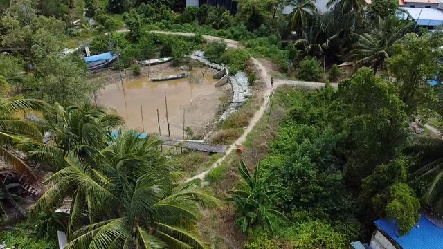
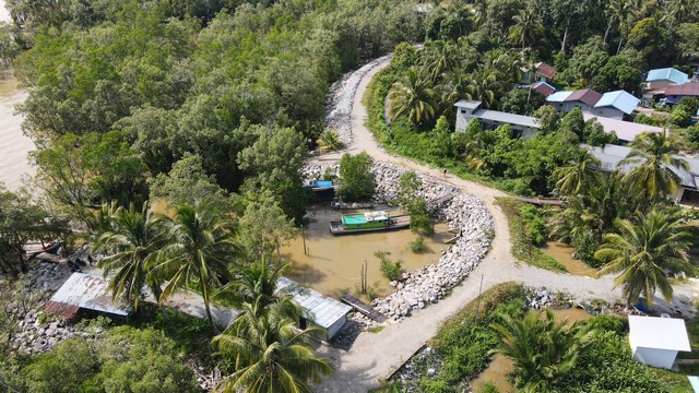
As the district experience an influx of physical development that also include new roads and bridges in years to come, it will be able to generate sustainable economic and social prospects through new opportunities in agriculture and fishing – sectors that are main sources of income for most locals.
The Sebangan Bajong Drainage Scheme, in particular, with its total area of 14,267ha can be revived as part of Samarahan Division’s aspirations to become an agricultural hub, which when developed will most certainly boost the economy of the area.
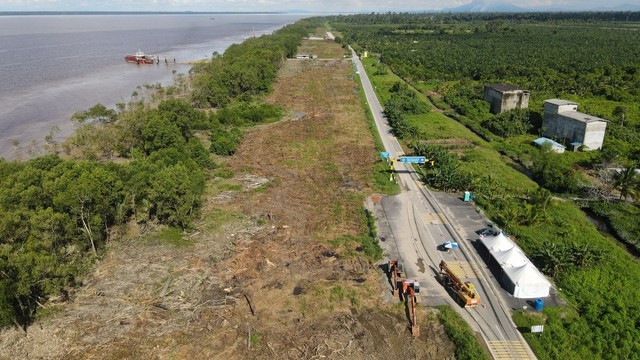
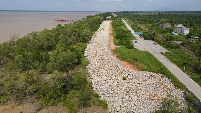
There also might be room to expand to new industries for Sebuyau District. Its strategic position facing the South China Sea together with improved road connectivity, for instance, could mean an opportunity to establish shipping or port activities.
Tourism could be on the cards as well; the district is located not far from islands of Pulau Burung, Pulau Triso and Pulau Seduku (where the famous Batang Lupar tidal bore or benak starts) – places that can be explored to attract both domestic and foreign visitors.
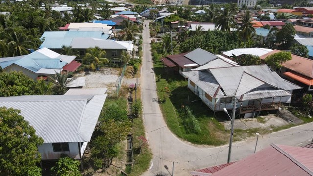
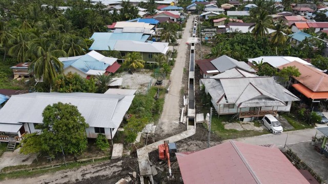
Yet Ir Irwandee stresses that all these possibilities can only be achieved if regular maintenance is implemented on all flood mitigation, embankments, drainage systems and other drainage and irrigation infrastructure in Sebuyau District.
Furthermore, any form of development in the future cannot exacerbate the district’s vulnerability to floods.
“This is where DID Sarawak’s main roles come in. Any proposed development implemented there will be refined and evaluated so that it takes account of proper drainage and irrigation system.
“There’s no use in developing a new township or increasing agricultural activities when they become susceptible to floods,” he elaborates.
The need to mitigate challenges of floods and coastal erosion in Sebuyau District, he adds, is a massive responsibility for the Samarahan divisional office of DID Sarawak.
Hence the reason why the Department strives to do so at an early stage is to guarantee the socio-economic prosperity of the people who have lived in the district throughout their lives.
Sebangan Bajong Drainage Scheme
Sebuyau District is home to the Sebangan Bajong Drainage Scheme, one of nine main drainage schemes supervised, operated and maintained by the Samarahan divisional office of DID Sarawak.
| Sebangan Bajong Drainage Scheme comprises 7 blocks: | Width (ha) |
| Sebangan Bajong Drainage Scheme Block A | 1,236 |
| Sebangan Bajong Drainage Scheme Block B | 2,503 |
| Sebangan Bajong Drainage Scheme Block C | 3,688 |
| Sebangan Bajong Drainage Scheme Block D | 2,220 |
| Sebangan Bajong Drainage Scheme Block E | 1,490 |
| Sebangan Bajong Drainage Scheme Block F | 1,500 |
| Sebangan Bajong Drainage Scheme Block G | 2,290 |
| TOTAL | 14,927 |
Source: Department of Irrigation and Drainage Sarawak, Samarahan Division Office
Roles and Functions of DID Sarawak
Flood Management
- Planning, implementing, and monitoring flood management master plans and flood mitigation projects, including policies, programmes and activities involved
Environmentally-Friendly Drainage
- Planning, implementing, and monitoring the Environmentally-Friendly Drainage Master Plan, including technical advisory services in development planning
Coastal and River Management
- Planning, implementing, and monitoring coastal erosion control projects, riverbanks, estuary conservation, rivers, river cleaning and projects located in coastal and river zones
Rural Infrastructure Development
- Planning, implementing, and monitoring irrigation and drainage scheme and infrastructure development projects
Hydrology and Water Resources (no section at DID Sarawak, Samarahan Division Office)
- Collecting, processing, analysing, storing, managing, and disseminating all hydrological and water resources data for use in studies in the assessment of development and management of state water resources
Source: Department of Irrigation and Drainage Sarawak, Samarahan Division Office
References:
BERNAMA. (2021, November 6). Projek tebatan banjir IRSDA tunjuk kejayaan awal. Harian Metro. https://www.hmetro.com.my/mutakhir/2021/11/774465/projek-tebatan-banjir-irsda-tunjuk-kejayaan-awal
Galileo, P. (2023, August 18). New township set to propel Sebuyau towards becoming coastal commercial hub. The Borneo Post. https://www.theborneopost.com/2023/08/18/new-township-set-to-propel-sebuyau-towards-becoming-coastal-commercial-hub/
Pentadbiran Bahagian Samarahan. (n.d.). IRSDA. https://samarahan.sarawak.gov.my/web/subpage/webpage_view/367/
Pentadbiran Bahagian Samarahan. (n.d.). Profil Daerah Kecil Sebuyau. https://samarahan.sarawak.gov.my/web/subpage/webpage_view/349/simunjando


